Our Services

Full-Service Expert Surveying & Mapping by Certified Specialists

At Borbas Surveying and Mapping, LLC we take great pride in our staff’s training, certifications, and superior qualifications. We are dedicated to providing the best possible services to our clients and continually strive to grow and expand our knowledge, reputation and geographic regions in an ever changing economic climate.

Our services are contracted by the private and public sectors with a concentration in facilities, transportation and the environment.  We supply services to Federal, State and local governments as well as corporations, domestic and international energy and chemical companies, professional business consultants, attorneys, engineers, architects, licensed site remediation professionals and geologists.

Facilities Mapping

Industrial and commercial facilities are constantly changing and being improved, due in part to the need to continually satisfy government regulations. So whether it be to help facilitate an improvement or to create an emergency disaster plan, we have the capability to map facilities that can serve any number of client purposes.

We re-create locations for our clients using state-of-the-art digital imagery and 3D laser scanning instruments, digital levels, and precise differential GPS. We then provide these deliverables to our clients in Geographic Information Systems (GIS) and CADD-compatible 2D and 3D vector, as well as 3D point clouds digital drawing formats.

Environmental Surveys

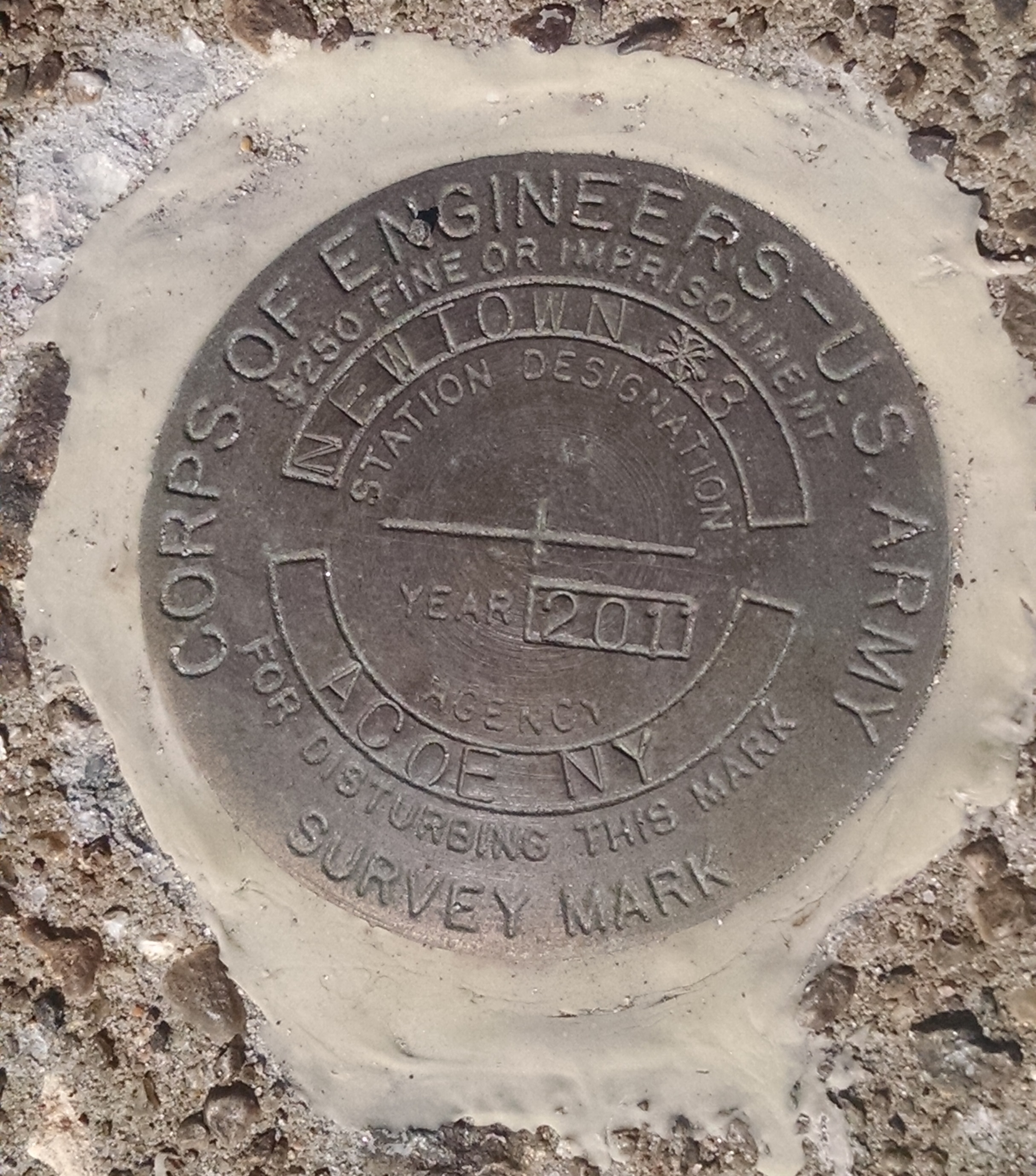
We have significant experience assisting government agencies with developing criteria for the reporting of ground water monitoring well surveys and developing procedures for the submission of electronic wetland application drawing files.bank restoration

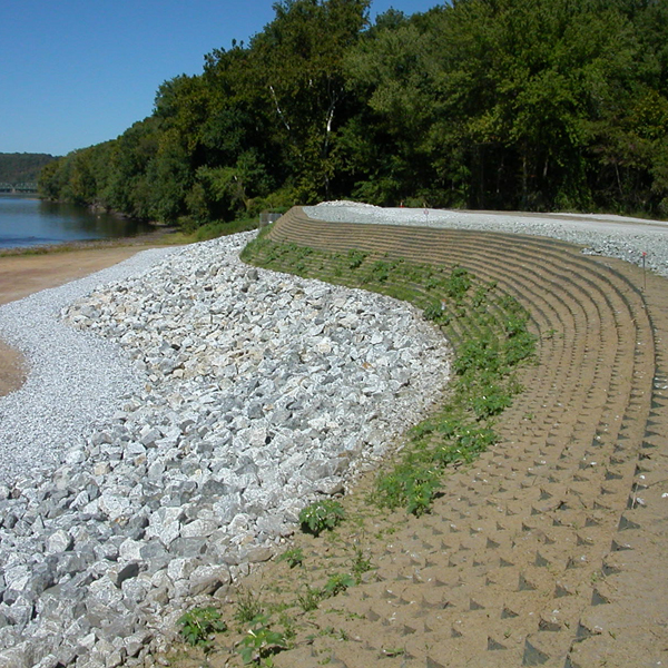
We are involved in everything from investigation and remediation of Superfund and Brownfield Sites to the creation of new freshwater, coastal and tidal wetlands. More than most any other surveying firm, Borbas understands the language and needs of the environmental scientist, engineer, compliance officer and licensed site remediation professional.

This expertise has been especially beneficial to our waterfront clients, who were forced to contend with repercussions from Hurricane Sandy. These repercussions included challenges such as large petroleum tanks floating from their pedestals and pumps, as well as electrical transformers being heavily damaged or destroyed. In addition, as a result of the storm, FEMA changed base flood elevations and we have been instrumental in helping clients understand and meet revised FEMA guidelines so they can rebuild their infrastructures to be in full compliance as well as to protect their investments.

Of course, this is not the full extent of what we can offer when it comes to environmental mapping. We are also adept at creating drainage and land use (DLU), topographical maps and General Site Plans (GSP) that can be used for a Discharge, Prevention, Containment and Countermeasure (DPCC) plan submission.

Part of our extensive knowledge in these areas comes from our active involvement with, and support of, the Licensed Site Remediation Professional Association and the Environmental Business Council of the Commerce and Industry Association of New Jersey.
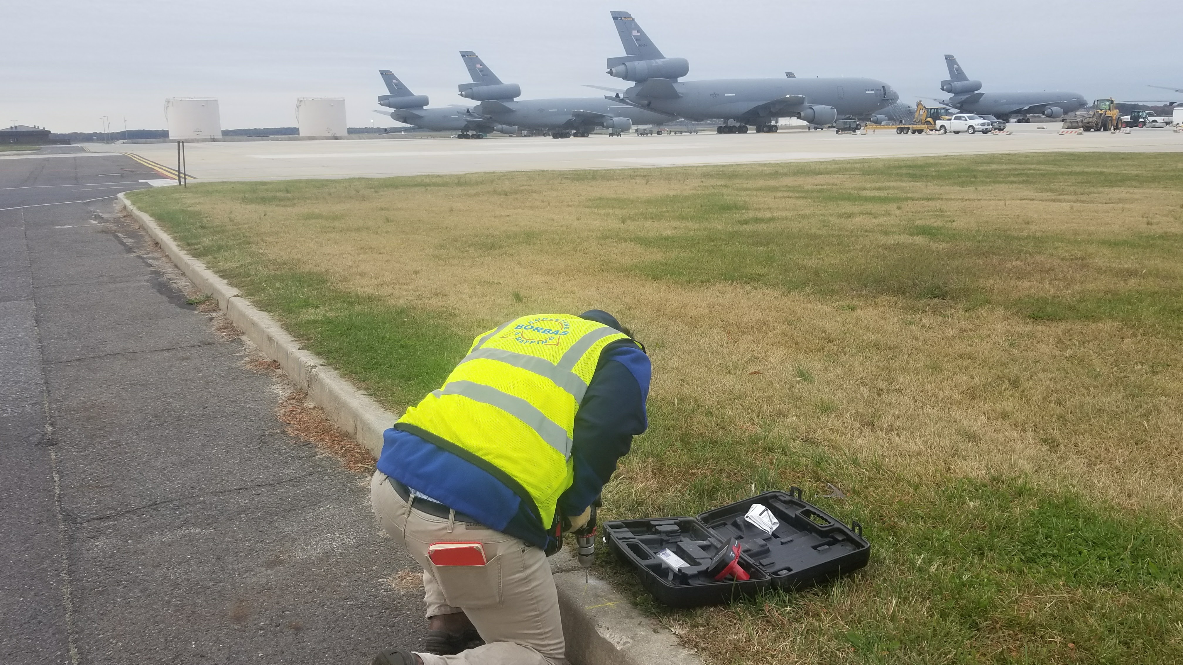
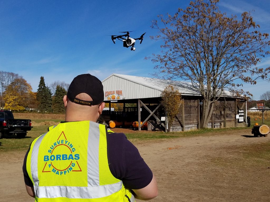
FAA AGIS Airport Surveys

The mission of the Federal Aviation Administration (FAA) is to provide the safest and most efficient aerospace system in the world. The FAA Airports Surveying Geographic Information System (AGIS) program helps to collect airport and aeronautical data to meet the demands of the Next Generation National Airspace System. NextGen—as it is known for short—will transform the air traffic control system from a ground-based system to a satellite based (GPS) system.

To support the FAA AGIS 18b survey requirements, we provide aerial and terrestrial surveying control and locations, as well as digital geographic information mapping. This demands a high level of expertise from us, as considerations have to be made concerning primary and secondary control, accuracy requirements, field survey, layer and feature class definitions, heights, distances, metadata, airfield surfaces, runway ends, navigational aides, obstruction identification and airspace analysis. To ensure we can meet the demands of these clients, our AGIS project manager is a FAA licensed pilot and ASPRS Certified Photogrammetrist who is highly experienced in aerial imagery processing.

Digital Mapping

Data sharing is an essential need for our clients. The most efficient way of sharing mapping data is through interchangeable digital drawing files compatible with a number of software programs. Regardless of whether you are working in AutoCAD, MicroStation, Arcview or another program, we have the capability to provide you with a digital drawing file that is compatible with your system and needs. We also ensure that all digital terrain mapping (DTM) and digital elevation models (DEM) will be prepared precisely and be spatially accurate.

For example, many government agencies (e.g., the NJDEP) require submissions in GIS compatible format, including shape files. Borbas is well versed in providing these deliverables, and our digital drawing files support plotting hardcopy black and white and/or color prints. Our computer systems also support 3D point cloud models for piping, buildings, structures and surfaces.

For those clients who have historic mapping in hardcopy (prints) format—such as pipeline right of way companies—we have the ability to convert hardcopy mapping to precise digital formats that are compatible with almost any software system.

Aerial Base Mapping/Remote Sensing

Whether it’s a tank farm, coastal wetland, right of way, military installation, airport or community, a large area base map may be right for your studies and plans. We can provide many options depending on your specific needs. In fact, we can provide aerial base mapping in digital vector, point cloud and traditional hardcopy formats.

New aerial digital cameras allow us to capture color imagery with pixel sizes as small as 1.7 centimeters. The center of each pixel can be converted to a point, and the points make up a 3D point cloud. These clouds are similar to LiDAR, but with the benefit of true color imagery. The digital files support traditional vector and contour drawing development. And unlike film or ground surveying, precise surface mapping can be generated from this very dense spacing.

Through testing, we’ve discovered that we can reach vertical precision between pixels down to the centimeter level. Our digital imagery supports creation of color orthophotography, which we produce ourselves.

We have always been held to a higher standard in regard to health and safety, and our drone services are no different. Our 4 pilots are fully insured and follow our robust aerial program.

Right Of Way Mapping

right of way
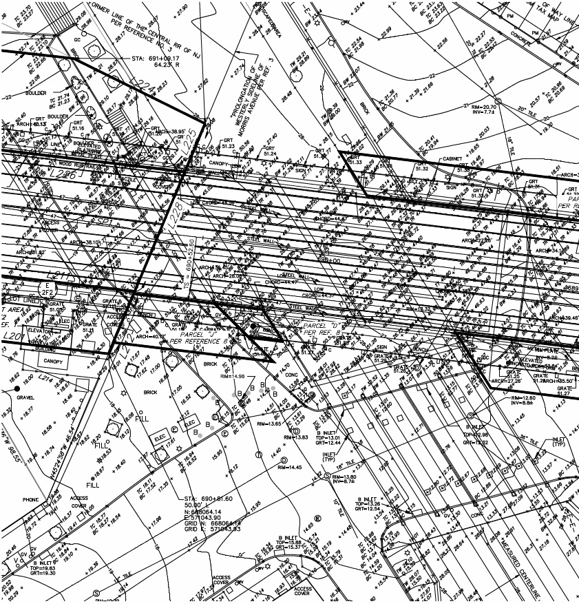
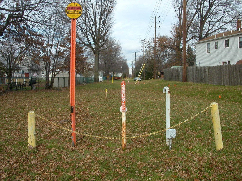
Railroads, pipeline companies, electric companies and departments of transportation require specialized right of way mapping for maintenance, planning, design, acquisition and improvements.

Borbas is an excellent source for Right of Way surveys because we understand the two critical components of these types of surveys: First, you need to possess a thorough knowledge of boundary and title law. Then, to conduct the survey itself, you need to be able to employ a combination of research, geodetic control, aerial imagery and ground surveying. With the advent of new aerial equipment, Borbas is incorporating unmanned aerial systems (UAS) technology to assist with difficult data acquisition.

Waterfront Surveys

The rise and fall of tides provide special situations that oil terminals, shipping docks, piers, and wharfs need to address, since much commerce is conducted along these tidal rivers, bays and harbors.

Not only do we understand the complexities and implications of tides, but we even teach other surveyors, engineers and GIS professionals how tides relate to an upland project site, how to work with complex FEMA data, and how to determine tidal elevations in NAVD88 or other project datums.

Our clients may have needs for use of the area of land flowed by the tide, and we work with clients and state agencies to determine and/or obtain usage rights for bulkhead restoration, pier and wharf construction, or bridge crossings.

We have the ability to create seamless computer models and mapping of lands under water, the bulkhead and uplands from the many types of sensors we employ.

GPS/GNSS Geodetic Control Surveys

For more than twenty years, we have been using, learning and testing state-of-the art technology, including GPS and high-accuracy coordinate pinpointing via the National Spatial Reference System (NSRS). As a result of these endeavors, we can effectively provide centimeter-level positioning in real-time or post process our observation data to obtain even millimeter-level positioning.

Borbas was a founding partner in a group that worked with Leica Geo Systems and the New Jersey Institute of Technology to develop and implement a high density real-time GPS/GNSS network across the State of New Jersey. Whether we are working for our clients in New Mexico, Kentucky, Massachusetts, New York, New Jersey or Delaware, we can tie into a real-time geodetic network system with any of our equipment.

Structural Surveys

barge drydock
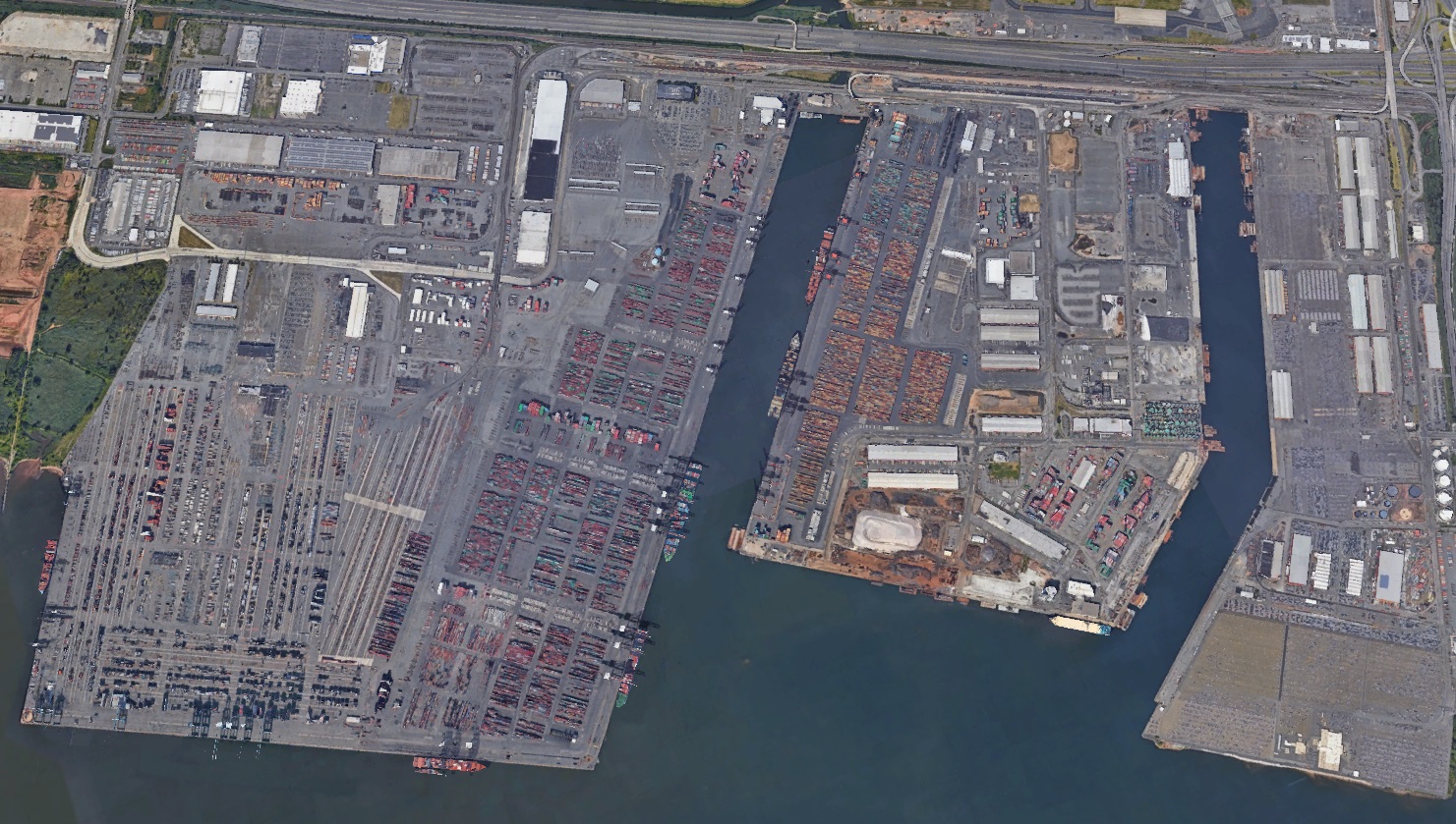
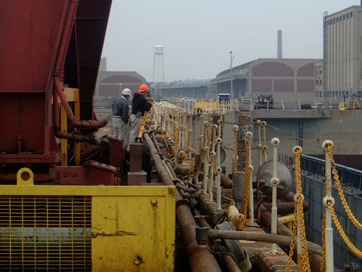
Ships, barges, buildings, tanks and walls…Borbas has worked on them all to provide the precise measurements and mapping engineers need for a variety of reasons:

  • Oil company clients may need us to monitor tanks for suspected or potential movement
  • Machinery may need to be dismantled and reassembled in another state or country
  • A damaged barge may need to be reconstructed and put back in service
  • Excavation work may need to be performed next to buildings or railroads and require the monitoring of movement, or change detection
  • Existing monuments may require surveying to assess shifts over time, movement, distortion, or damage in the event of a natural disaster

Whatever the demand, we can perform structural surveys with the same level of expertise our clients have come to expect from our other survey offerings.

Existing Condition And As-Built Surveys

Prior to performing studies, design and analysis, we are often asked to prepare existing condition surveys to support our clients’ work or that of others. As-built surveys verify compliance with approved design plans and provide a legacy record for both internal and external use, such as pipeline companies.

At the outset, we determine the needs of all parties and set the criteria for the existing conditions survey. Many of these surveys are used for soil and volume calculations, drainage design, bridge and highway design and site planning.

ALTA/ACSM/NSPS Certified Boundary Surveys

The American Land Title Association and the American Congress on Surveying and Mapping jointly established standards and specifications for the preparation of boundary and title surveys.

Using a nationally-accepted standard benefits our clients, since it provides assurance that their survey is the best it can be and accurately depicts metes and bounds and second or third-party interests in land for properties in question. The ALTA/ACSM standard has optional items that can be added to the survey.

You can view the entire standard and optional Table A Items by downloading the form here.

Hydrographic and Bathymetric Surveys

Borbas_Survey_boat_08
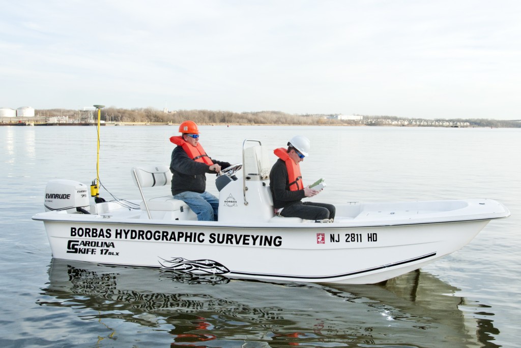
Our surveying offerings extend to those lands flowed by both fresh and salt water. Our hydrographic skiff is equipped with a real-time kinematic (RTK) GPS/GNSS antenna mounted directly above the sonar sensor so we can provide real-time elevations in NAVD88 or your particular project datum. As a result, we can effectively offer underwater topographic surveys of watersheds including rivers, ponds, lakes, reservoirs, bays and harbors.

The hydrographic and bathymetric surveys we conduct support flood study analysis, scour analysis of bridge piers, dredging analysis, erosion analysis and dam studies. Files are provided in digital models and drawings as well as in hardcopy formats.