Topographic Mapping of Polluted Sites Aids in Remediation Efforts
Civilization places heavy stress upon the Earth. Our planet is forced to endure population growth, more than a century of environmental hazards, and an increasing demand for clean water.
Clean water is an especially threatened commodity. Heavy industry, lack of controls over chemical dumping, and commercial and residential development have polluted waterways and significantly diminished the availability of clean water. Expanded development has also contaminated or threatened the protection of aquifers and reservoirs.
Borbas Surveying and Mapping has actively participated in the identification and remediation of contaminated soils and groundwater.
Helping Rescue Jersey’s Most Famous Superfund Site
The Ventron/Velsicol site in Wood-Ridge, New Jersey is a 40-acre Superfund site that used to contain a chemical processing plant. Hazardous chemicals were found in the soil and ground water, while fish and other organisms were found to have a high level of mercury.
The EPA determined that mercury and other hazardous chemical discharges from the facility had contaminated Berry’s Creek, a tributary within the New Jersey Meadowlands. The Meadowlands is a roughly 8,400 acre ecosystem of wetlands in northeast New Jersey that contains both undeveloped and developed areas. It is an environmentally fragile and critical area for humans and wildlife that has endured heavy pollution from industrial waste, landfills, and overdevelopment. The area is being remediated to restore its viability as a wildlife habitat and recreational area.
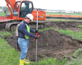
Borbas was called upon to provide topographic mapping to determine ground and contamination elevations relative to tidal influence. Through mapping of borings and monitoring wells throughout the area, environmental scientists were able to determine the full extent of chemical contamination and develop plans for remediation.